Sustainable Streets Master Plan
What if the streets in our communities were better designed to provide safety and protection for pedestrians and cyclists, help increase resilience against the effects of climate change, and beautify our neighborhoods?
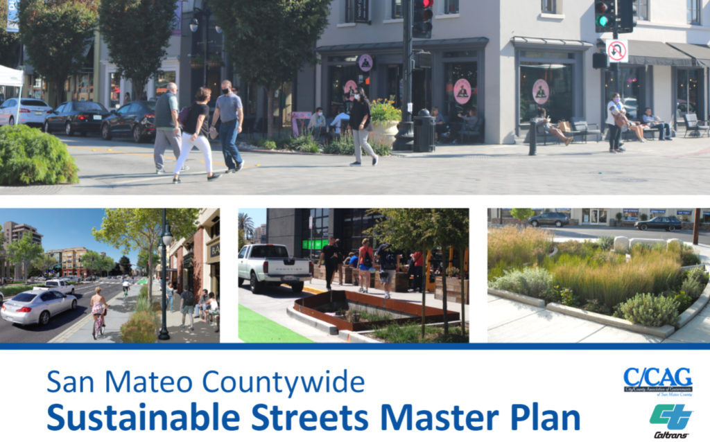
To take the leap toward sustainable streets throughout the county, the City/County Association of Governments of San Mateo County created the San Mateo Countywide Sustainable Streets Master Plan in collaboration with Caltrans under the Climate Adaptation Planning Grant Program. This website is the permanent home for the plan and its associated documents. This long-term planning effort builds on years of watershed modeling and stakeholder input, and takes a closer look at how and where to build sustainable streets in San Mateo County that integrate stormwater management with local priorities, like bike and pedestrian mobility, transit improvements, climate change adaptation, and more. The plan also includes a down-scaled climate change analysis to better understand the potential future precipitation related impacts from climate change and how green stormwater infrastructure can help adapt to changing conditions.
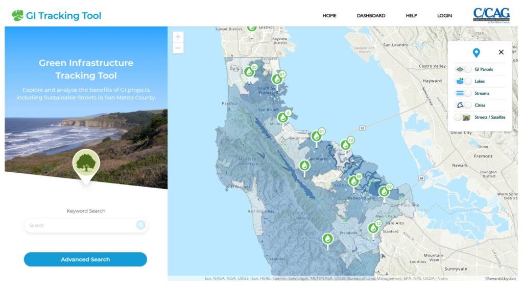
Below you can download the Master Plan and Appendices directly. The San Mateo County Green Infrastructure Tracking Tool is designed to visualize green infrastructure projects (including sustainable street projects) throughout San Mateo County. This tool can be used to explore completed projects and associated performance metrics for managing stormwater under current or projected future climate conditions.
Master Plan and Appendices
Download the Master Plan Appendices below:
C. Recommended Sustainable Street Planned Project Opportunities (.7 MB)
D. Recommended Sustainable Street New Project Opportunities (.6 MB)
E. Sustainable Street Priority Project Concept Designs (67.4 MB)
F. Sustainable Street Policy Development (.5 MB)
G. Sustainable Street Technical Suitability and Co-Benefit Maps (13.1 MB)
H. Sustainable Street Stormwater Curb Extension Feasibility Assessment Tool (1.2 MB)
I. Sustainable Street Community Engagement Reports (57.8 MB)
J. Typical Details for Sustainable Streets (10.3 MB)
If you would like a guided tour of the Sustainable Streets Master Plan, watch the recording of the Virtual Open House below that took place on December 8, 2020. Presenters explain how and why this plan was created and explore the tools and resources developed in the plan to support municipalities starting their sustainable streets initiatives. You can also check out the Sustainable Streets Master Plan Community Engagement Hub, where you can tour the main elements of the Master Plan from a thirty-thousand foot view.

The Green Infrastructure Tracking Tool is a mapping and tracking visualization tool, designed to visualize and track progress toward urban greening, water quality and sustainable streets implementation goals in San Mateo County. The tool includes a visualization map of project locations and stormwater treatment measures (e.g., bioretention, pervious pavement, tree wells, etc.).
What Are Sustainable Streets?
Within the context of a street, the term “green streets” is often used to describe streets that have green infrastructure built into the sidewalks and roadways, allowing water to soak into the land rather than drain straight to the bay or ocean.
There are many competing needs and uses for our streets, especially with respect to mobility, safety, and community comfort and livability. Transportation planners refer to streets that are designed with enhanced bus stops, cycle tracks, pedestrian-oriented road-crossings, and other improvements to facilitate mobility of all users of the road as “complete streets.” Taken together, green infrastructure and complete streets can maximize the benefits of each and lead the way towards what we call “sustainable streets.”
In fact, the benefits of green infrastructure extend well beyond cleaning and managing water. Rain gardens, stormwater curb extensions, green roofs, and street trees (among other green infrastructure types) can also directly enhance pedestrian and bicycle mobility and safety, contribute to traffic calming, add urban green space and wildlife habitat, enhance neighborhood livability, help deepen residents’ sense of connection with the natural environment, and control localized flooding and heat island effects. Most communities in San Mateo have a complete streets policy to help create safer and more comfortable street environments for everyone, and many are developing or have developed sustainable streets policies or green infrastructure plans to sustainably manage stormwater.
See the animated graphic below that shows the progression of a regular street, to a complete street, to a sustainable street.
To see what’s happening in our county already, view the map below
To see what’s happening in our county already, view the map above and click on individual green infrastructure projects throughout San Mateo County to learn more about local green infrastructure projects in your neighborhood – and take a look next time you’re out for a stroll!
If you’ve not been satiated by everything on this page, take a look at the Countywide Stormwater Resource Plan for background information and to learn the nuts and bolts of how green infrastructure planning got started in San Mateo County.


Comments are closed.